


New Technologies For Fruit Growers
As most growers know, there is always room to improve. Here then are some products released in the past year that might pique your interest. Whether you’re looking to improve your Integrated Pest Management (IPM), make your labor management more cost-effective, or perhaps delve into precision agriculture, here are a couple of products that are state of the art.
Employee Tracking
Payroll Employee Tracking (PET Tiger) is a paperless and wireless labor management system that integrates multiple devices such as regular time clocks, biometric clocks, handheld devices, and smart phones. While performing field operations, harvesting, packing, transportation, and administration, those devices send data to a single database. Ag operations with all crops are electronically monitoring labor data to make efficient management decisions in real-time and improve overall productivity and transparency.
Current mobile communication technology makes it possible for agricultural operations to make labor decisions with greater precision in real time. Now owners, managers, and supervisors see productivity throughout a work day rather than wait until the end of a work week.

PET Tiger data mapping visually provides, on a map, the status of a company’s labor force. At any given time you can click on the flag in a map and see who is working in the field, what task is being performed, how much productivity has been achieved, and what equipment is being used. This feature allows supervisors, managers, or owners the ability to make decisions while in or out of the office. The maps are accessible on any mobile device with internet access like smart phones, iPhones, and tablets, as well as laptops or PCs. The collected data is used for import to accounting software to process payroll checks and provide an exceptional cost accounting system. The time invested into payroll processing significantly decreases with use of the PET Tiger.
For more information, go to www.TigerJill.com.
IPM Module
Davis Instruments has a new Integrated Pest Management (IPM) Module for Stone Fruits, including peaches, apricots, cherries, plums, and prunes. The new software links fruit growers’ weather data to actual pest risk, giving them a powerful new tool in the battle against stone fruit crop pest damage. This latest IPM module, for stone fruits, follows Davis Instruments’ IPM for Grapes and IPM for Apples/Pears Modules, which have been used in the last two growing seasons.
The IPM module is an add-on software component that integrates with Davis Instruments’ WeatherLink software. Weather conditions are measured using Davis’ wireless Vantage Pro2 equipped with a leaf wetness sensor. Using real-time temperature, humidity, rain, and leaf wetness data from Vantage Pro2, IPM for Stone Fruits generates stepped risk levels to warn when conditions are most susceptible to pest development. While the software is loaded with pest models for all known stone fruit pests, including diseases, insects, and mites, growers may customize the IPM software to track pests specific to their areas.
“Davis Instruments is committed to using weather technology to help farmers with their crops,” said Susan Foxall, marketing director. “Our on-site botanist and meteorologist have worked closely together to develop the most accurate pest models possible. We believe our pest management package (the IPM module, wireless Vantage Pro2, Wireless Leaf & Soil Moisture/Temperature Station, and WeatherLink) is the most comprehensive in the market and an essential tool for healthy crops and healthy profits.”
From their PC, fruit growers can easily see when conditions are favorable for insect pests to reach a damaging stage of growth, or for disease development to occur. A color-coded spreadsheet prioritizes the highest risk potential pests at the top of the list and highlights them in red. Farmers can configure the software to reflect those pests present in their specific area. The software uses the pest configuration and real-time data from orchard weather sensors along with the updated pest development algorithms to deliver the most accurate, orchard-specific risk assessment available.
For more information go to www.davisnet.com.
Data Management
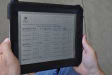
iCropTrak version 3, just released at the Apple App Store, expands available GIS data management features to allow field boundary and infrastructure maps to be managed entirely from the field. New capabilities allow users to digitize by drawing directly on the screen of an iPad or iPhone to create new block boundary information or add multiple data layers to the displayed map information. Support for establishing management zone boundaries within blocks simplifies the opportunity for the adoption of precision farming practices.
“We have taken the footprint of your desktop GIS software and removed the weight of the office, the licensing expense, the learning curve, and the inability to share the data,” announced Rob Wood, iCropTrak Product Director. “Any iCropTrak user with appropriately assigned user role can keep map updates at their fingertips and the new boundaries, features, or management zones that are added can be instantly shared with other users,” he added.
The GIS map data management capabilities built into iCropTrak include the following capabilities:
• Add a new farm geographic data container directly from the iPad (or iPhone)
• Define geographic data layers (e.g. field boundaries, irrigation infrastructure, planting plan, drainage infrastructure, roads, and services)
• Specify the layer type (e.g. polygon, line, point)
• Digitize data in the field with GPS or by using your finger in Draw mode
• Edit vertices to move lines, points, or boundaries
• Specify the layer properties: Color and fill style, and border width
• Set transparency
• Set display zoom level
• Set label size, color, and masking
• Import as applied data (point data, raster data)
• Import raster layer data (e.g. NDVI)
• Create zones (e.g. an area of frost damage, an area of poor drainage, a buffer zone, a setback zone)
• Use built in digitizing tools for laying out regular shapes like circles (e.g. center pivot) or grids
• Measure distance and area
• Generate grid sampling layouts and sample points
• Import and export ESRI shape files
For more information, go to www.icroptrak.com.
Steering System
Topcon Precision Agriculture (TPA) announces the AGI-4, the industry’s first completely integrated steering solution that can simply and easily interface with many manufacturer’s “virtual terminals” (ISO11783).
Just released in January, the AGI-4 features multiple-constellation GNSS satellite reception, state-of-the-art inertial sensors for full terrain compensation, plus Topcon’s industry-leading line acquisition and on-line steering functionality.
“The AGI-4 is an industry first in all-in-one integrated receiver/steering controllers,” said Kevin Cobb, TPA director of product management.
The AGI-4’s modular design includes “antenna, multi-constellation GNSS satellite receiver, and steering controller, with optional high-accuracy inertial sensors snap-in module offering unmatched ‘upgradeability,’” Cobb said.
AGI-4 comes standard with WAAS and EGNOS steering functionality and an RTK communication module is also an available option. “AGI-4 is easily ‘upgradeable’ to 2cm accuracy with RTK radio options,” Cobb said. NTRIP capability allows a user to tap into existing reference networks via mobile phone connection (dependent on local availability) and uses existing data plans and infrastructure to minimize costs.
“AGI-4 features include industry-leading ISO11783 compatibility with virtual terminals. This allows the addition of Topcon’s industry-leading auto-steering performance to virtually any steer-ready vehicle via a single component installation,” said Cobb. “Being compatible with the displays of many other manufacturers lets the AGI-4 steering controller give true drop-in and drive convenience.”
For more information, go to www.topconpa.com.
Subscribe Today For