Dry Season Setting Up To Be Stormy For Central, South Florida
According to the National Weather Service, this year’s extra strength El Niño climate pattern will contribute to a wetter and stormier dry season across much of Florida.
Along with more storm chances will come an increased risk of tornadoes.
Scientific reports indicate the present El Niño phase could end up being one of the strongest on record (since 1950). Historically, El Niño events have produced significant tornadic storms across the Sunshine State.
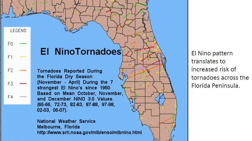
Image courtesy of the National Weather Service
Another El Niño characteristic is cooler-than-normal temperatures during the dry season, especially during the winter months of December through February. Much of this is caused by more frequent cloudy/rainy episodes.
Despite relatively cooler temps overall, overnight and early morning low temperatures tend to remain relatively mild due to greater influence of storm systems from the Pacific Ocean. This normally means a reduced risk of freeze events. However, this certainly was not the case during the El Niño of 1982-1983 when Florida saw severe freeze events.
Subscribe Today For