Climate Conditions Go In for a Double Dip: Here Comes La Niña – Again!?
La Niña conditions are setting up once again for this coming winter. Cooling waters in the tropical Pacific are an indicator of the climate phase.
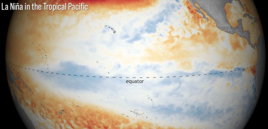
Image courtesy of NOAA
Here we go again. It appears a La Niña has developed and will extend through the second winter in a row, according to NOAA’s Climate Prediction Center.
La Niña is one part of the El Niño Southern Oscillation (ENSO) cycle, which is characterized by opposing warm and cool phases of oceanic and atmospheric conditions in the tropical Pacific Ocean. During La Niña winters, the southern tier of the U.S. is often drier and warmer than normal while cooler and wetter in the Northwest.
Consecutive La Niñas following a transition through ENSO neutral conditions are not uncommon and is referred to as a “double-dip.” In 2020, La Niña developed during August and then dissipated in April 2021 as neutral conditions returned.
This La Niña is expected to last through the early spring 2022. As it stands for now, there is an 87% chance of La Niña for the upcoming winter season (December 2021 through February 2022).
Previous La Niñas of note occurred during winter 2020-2021 and 2017-2018. El Niño took back the reins in 2018-2019.
La Niña also is often associated with heightened tropical activity in the Atlantic basin, as wind shear is reduced, allowing storms that form an easier path forward. This hurricane season has been another active one, with primary storm names reaching the limit – only Wanda remains on the list as of this post. Will the current developing La Niña extend this season’s hurricane season beyond the normal Nov. 30 conclusion?
Check out the video below for a detailed explanation of La Niña and how it affects our weather.
Subscribe Today For