



How a Strong El Niño Can Affect Hurricane Season Forecasts
 July 8, 2026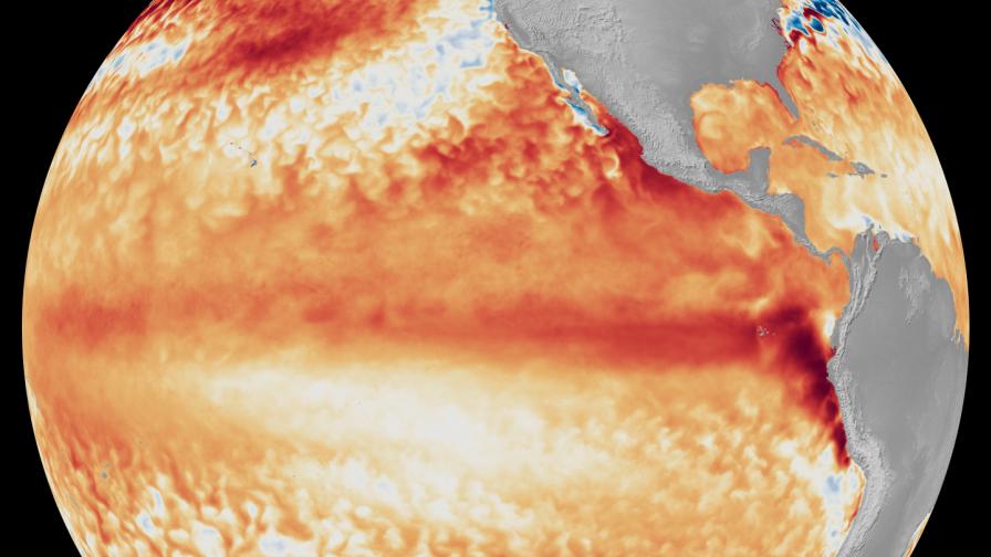
Satellite data from last month shows the tell-tale signs of a strengthening El Niño event. The dark ribbon of red indicates abnormally high sea surface temperatures. Image: NOAA Satellites
When it comes to hurricane season forecasts, there is no larger influence on predictions than climate phase. When first outlooks for the 2026 Atlantic hurricane season were released in the spring, the numbers were tempered compared to recent years. Why? Climatologists noted the presence of a developing El Niño. But not just any El Niño. Expectations were this could be the strongest event seen in quite some time.
Fast forward a few months. Today, all the ingredients are there to indicate a strong El Niño is in progress. An El Niño usually means a slower tropical season in the Atlantic basin. With that, forecasters have adjusted their initial numbers accordingly.
Dr. Phil Klotzbach and his team at Colorado State University (CSU) initial 2026 Atlantic hurricane season forecast released in early April looked like this:
- Named Storms: 13 vs. (30-year historical average: 14.4)
- Hurricanes: 6 vs. (30-year historical average: 7)
- Major Hurricanes: 2 vs. (30-year historical average: 3.2)
As of the July 8 update, CSU’s forecast has shifted noticeably.
- Named Storms: 9
- Hurricanes: 4
- Major Hurricanes: 1
Part of the updated forecast summary from Klotzbach and crew reads as follows: “We further reduce our 2026 Atlantic basin hurricane season forecast and now anticipate a well below-normal season. Moderate El Niño conditions are likely to intensify over the next few months, with a high potential for a strong El Niño for the peak of hurricane season. Sea surface temperatures across the Caribbean and tropical Atlantic are near their long-term averages. We anticipate the powerful El Niño being the dominant factor for the upcoming hurricane season, driving high levels of tropical Atlantic vertical wind shear.”
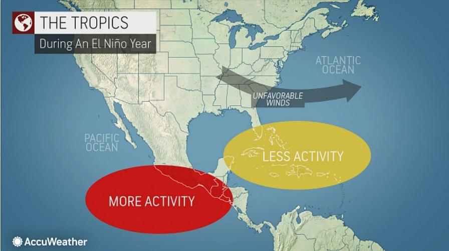
The 2026 Atlantic hurricane season is off to a slow start. Indeed. There has only been one named storm so far (Arthur). The weak, short-lived system that formed along the Texas coast in mid-June was barely a blip on the radar. Since then, increased vertical wind shear across the main development region, along with consistent Saharan dust plumes traveling across the Atlantic, has kept things quiet. But most hurricane seasons — El Niño or not — don’t really start heating up until mid-August and beyond.
The National Hurricane Center released its official Atlantic hurricane season forecast in May. Its forecasters were predicting 8 to 14 named storms; 3 to 6 hurricanes; and 1 to 3 of those being major. The government agency’s next update isn’t until August. Similarly to CSU and others, the numbers are likely to reduce.
Seasonal Temperature and Precipitation Outlooks
Besides its influence on the hurricane season, a strong El Niño could have other weather extreme repercussions for folks that can impact livelihoods like agriculture.
Check out NOAA’s July-August-September Temperature and Precipitation Outlooks to see which parts of the U.S. are likely to see extremes.
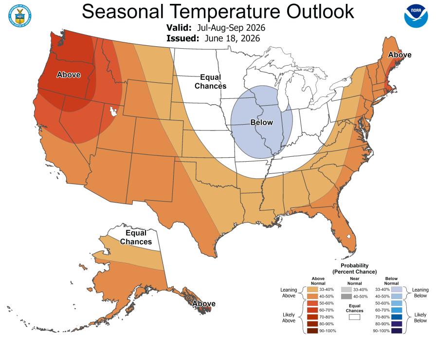
Graphic: NOAA
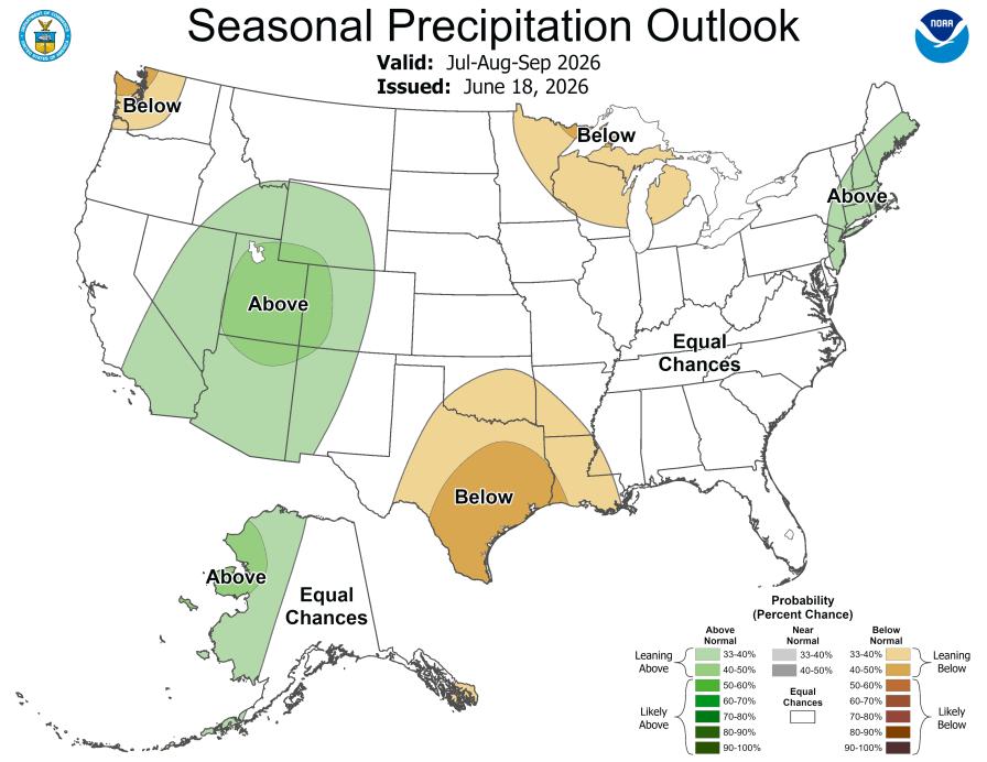
Graphic: NOAA
Stay tuned. Weather is hard to predict from day to day let alone months ahead.
It only takes one to make it a memorable hurricane season. Let’s keep watching together.
Subscribe Today For
