


Unmanned Aerial Vehicles Give Viticulturist An Eye In The Sky
 January 6, 2015
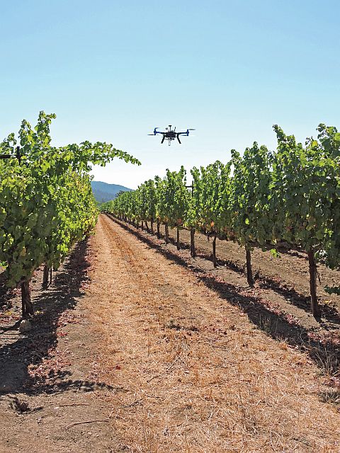
A Y6 multicopter returns from a flight over a winegrape vineyard. (Photo credit: Discover Sonoma County Wine)
Ryan Kunde, winemaker FOR DRNK Wines near Sebastopol, CA, says flatly that he makes better wines now that he flies an Unmanned Aerial Vehicle (UAV) over the vineyards from which he sources grapes.
“I was the first to pick — others were a week later — and I nailed it,” he said of his 2014 Sonoma Valley Sauvignon Blanc. “I got exactly what I wanted.”
 As a decision-making aid, there’s nothing quite like the images he gets by flying a 33 millimeter camera affixed to a small airplane over vineyards.
“I like the mapping it enables me to do,” he says. “For sampling, it really helped me this year.”
Born To Fly
Kunde (pronounced “Kundee”), 33, is the next generation representative of the Kunde family, which is well-known in the Golden State winegrape industry. They’ve been farming in the Sonoma Valley for over more than a century. Ryan Kunde grew up in the winegrape business and loved remote-controlled cars as a boy, so his current fascination with using UAVs to produce better wines should come as no surprise.
As he grew older, Kunde would go up into the hills and watch men flying remote-controlled airplanes. These were of an earlier generation, and planes were gas-powered, unlike the electric planes he now flies. Kunde recalls asking the men why they didn’t put cameras on their planes.
“They said it was too heavy and wouldn’t work,” he scoffs.
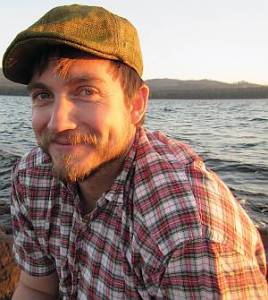
Ryan Kunde has had a lifelong fascination with remote-controlled vehicles. (Photo Credit: DRNK Wines)
In 2009, Kunde went to a Maker Faire in San Mateo, an event that celebrates arts, crafts, engineering, science projects and the “Do-It-Yourself (DIY)” mindset where a speaker talked about putting a cell phone on an unmanned plane and activating a Global Positioning System (GPS).
It was there that Kunde learned of the online forum, DIYDrones.com, which describes itself as “The leading community for personal UAVs.” The forum’s popularity shows just how fast UAVs are catching on.
“When I joined there were less than 2,000 people,” he says, “and now ther are tens of thousands.”
Flying, Crashing
At the time, Kunde was studying viticulture and enology at the University of California-Davis. While he’s now a winemaker, not a grower, and sources grapes from others, he is well-grounded in soil science. In fact, at that time he was working in the UC-Davis soils lab, studying the use of biochar for carbon sequestration in a walnut orchard. He spent nearly a year on the project, doing experiments and analyzing data.
It occurred to him that the use of aerial imaging might helpful in studying the health of the block, and so he flew his plane over it, mounted with a
35 mm camera.
“I came back with beautiful images of the walnut orchard — I could really see the plant health and quality,” he says. “I asked the research chief if they were gathering such images, and they weren’t, so I needed to do this on my own because better science could not only mean reduced inputs, but fewer greenhouse gases.”
Of course, it wasn’t easy at first.
“I was flying and crashing a lot of planes,” he says with chuckle. “I was really on the bleeding edge of it.”
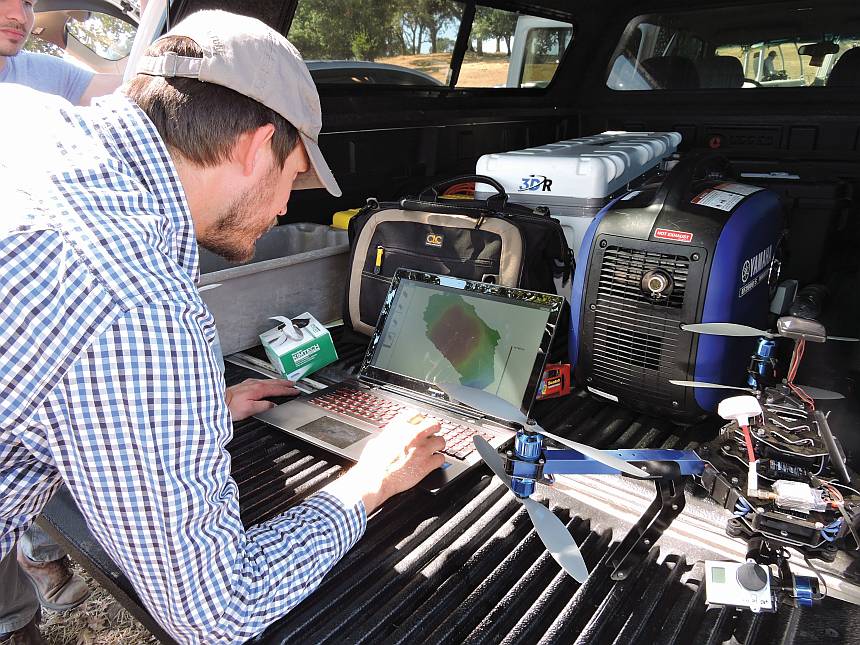
Ryan Kunde uses the photos captured from flights to map the vineyards. (Photo credit: Discover Sonoma County Wine)
Starting Out
Lately, Kunde has been using foam planes with a wingspan of about 4½ to 5 feet. They are perfect for the larger vineyards from which he sources grapes. For smaller vineyards, people might want to use an aircraft similar to a small helicopter, called a multicopter.
“Each has its strengths, and both are easy to control, but it does take training,” he says. “You’re not going to take it out of the box and not crash.”
Perhaps the trickiest thing to learn is how to fly the UAV both directly away from you and directly toward you, as the controls are not intuitive. Kunde says novices should consider getting a flight simulator to run on their computer. To get started, you can simply Google “Free Flight Simulator.” Of course, the better, more sophisticated simulators come with a price tag.
People interested in trying out the technology have to understand that like anything else with a fair amount of sophistication, it will take time. After beginning to fly, Kunde estimates that it takes about three months to become proficient, six months to become truly skilled.
“Of course, it depends on how you often you do it,” he says. “It can take a lot of training, depending on your initial level.”
Speeding Up
The good news is that it learning curve should become faster and easier in the future as more and more people become interested and the technology improves.
This will get streamlined, it will become easier and faster, more intuitive than it is now,” he says. “Now it requires a lot of time.”
More companies are getting involved with the technology, which should also speed the overall adoption. Kunde is now flying in association with a company called 3D Robotics, and he gives them feedback on the field use of the machines. Also, he notes that companies that have been working in agriculture for years, such as Trimble, are also getting into the field. As more companies get involved, as with any other technology, costs should come down.
Currently, Kunde estimates systems start at about $2,000, and can range up to $20,000 or more. For a system with the plane he flies, Kunde says the cost of the system is about $6,000.
In any case, Kunde he is excited about the possibilities. For example, Kunde he is fascinated by hydrology, and the UAV allows him a vantage point that otherwise wouldn’t be available
“The most important indicator of the water usage of a vineyard is the foliage,” he says. “With aerial photography from where the sun is, I get to see what the sun sees, and that makes the images especially useful.”
But that view from the sky aside, to make it a bottom-line benefit still requires putting in the field work.
“I’m a winemaker, so it can help me view the vineyards I will be sourcing winegrapes from,” he says. “But then I ground-truth by sampling the vineyards based on the imagery. It’s not just about images — you have to do the footwork as well.”
Subscribe Today For