Wicked Winter Coming This Way Says Latest Farmer’s Almanac Posted by Paul Rusnak|August 17, 2015 Super El Niño-influenced weather patterns align to paint a less-than-pretty portrait.Read More
Vegetable Industry Allies Offer Advice for the Next 5 Years Posted by Growing Produce Staff|July 22, 2026
4 Fruit Varieties You Might Want To Add to Your Crop Portfolio By Growing Produce Staff|July 21, 2026
Video: Why Chasing High Prices Can Backfire on Vegetable Growers Posted by Growing Produce Staff|July 21, 2026
FDA Continues Focus on Lettuce in Cyclospora Outbreak Probe Posted by Growing Produce Staff|July 20, 2026
International Report Confirms 2014 As Earth’s Warmest Year On Record Posted by Paul Rusnak|July 21, 2015 Scientific compilation notes climate markers continue to show global warming trend.
El Niño Could Be Strongest In 50 Years Posted by Christina Herrick|July 14, 2015 In the latest AccuWeather report, Brett Anderson, senior meteorologist with AccuWeather says El Niño has strengthened over the […]
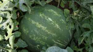
High Heat Impacts Georgia Watermelons Posted by Rosemary Gordon|July 14, 2015 Numbers are expected to be lower this year, but it is too early to tell by how much.
Record Heat Wave Expected To Hit Pacific Northwest By Growing Produce Staff|June 4, 2015 A warm ridge of high pressure off the Pacific Ocean may park itself over the region, delivering a burst of hot weather peaking Sunday through Tuesday and perhaps longer.
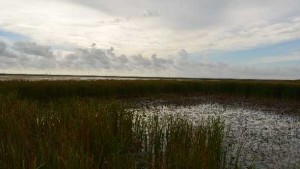
South Florida Rainy Season Could Wind Up On Drier Side Posted by Paul Rusnak|May 20, 2015 National Weather Service anticipating El Niño to play a hand in possible below-normal conditions.
Bad Weather Or Not, Preparation Always On Radar For Florida Farmers [Opinion] By Paul Rusnak|May 19, 2015 You cannot prevent a natural disaster from taking everything you have, but you can lessen the blow if and when it happens.
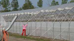
Save Your Greenhouse Structures From Storms By Paul Rusnak|May 19, 2015 Make sure your protected agriculture components are prepared for whatever may blow this way.
Wet Season Off To Extremely Early Start In South Florida Posted by Paul Rusnak|May 1, 2015 Some areas saw more than 200% above-average rainfall during April.
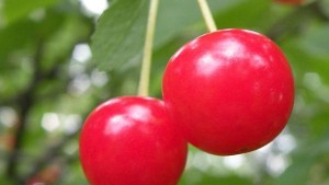
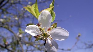
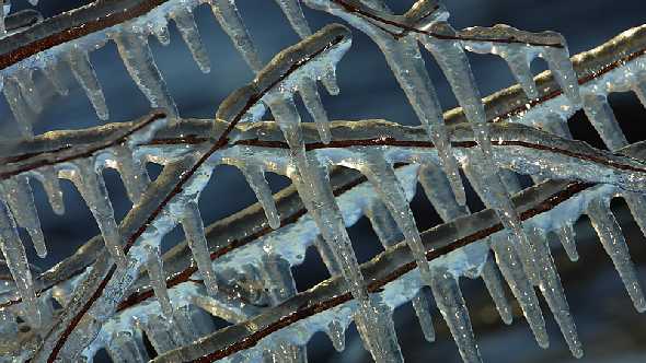
Winter Storm Surprises Utah Fruit Growers Posted by Christina Herrick|April 20, 2015 Snow and cold temperatures threatened tart cherries already in full bloom.
March Was The Fifth Warmest Month On Record In Washington By Growing Produce Staff|April 20, 2015 Wapato recorded all-time high of 80 degrees.
Record Low Snowpack In Washington State By Growing Produce Staff|April 14, 2015 Experts say snowmelt occurring earlier than expected.
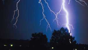
Forecasters Predict Historically Weak Atlantic Hurricane Season By Growing Produce Staff|April 9, 2015 Extended range outlook cites El Niño as culprit in what could be one of the least active seasons in recent memory.
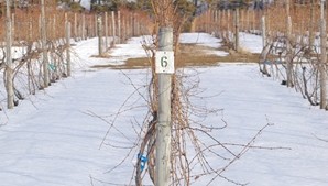
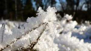
Northeast And Midwest Grapevine Winter Injury Report By Ann-Marie Jeffries|April 9, 2015 Temperatures dropped as low as -30° F in some areas, which has growers preparing for another rebuilding year.
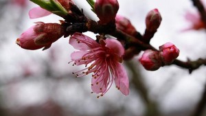
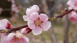
Southeast Peach Growers Impacted By Cold Snap By Growing Produce Staff|April 7, 2015 Blooming trees hurt by freezing temperatures; some growers suffered significant loses.
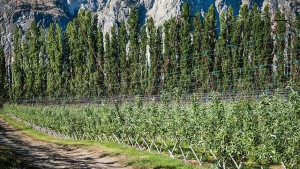
Cold Spell Hits Mid-Columbia Region By Growing Produce Staff|April 3, 2015 Cherry and grape growers use wind machines, irrigation to protect early blooms and buds from freezing temperatures.
Rainfall Relief Welcomed Across South Florida By Growing Produce Staff|April 3, 2015 Below-average precipitation for the region during March helps lower high water levels from what has been a rather wet Dry Season.
Southern Strawberry, Peach Growers Concerned About Cold Snap By Growing Produce Staff|March 31, 2015 Plastic coverings, sprinklers used to keep crops warm with consecutive nights of low temperatures.
Growers Worry About Winter Injury In East, Early Bloom In Washington By Growing Produce Staff|March 17, 2015 Warm February puts cherry crop two weeks early.
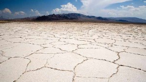
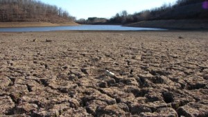
Megadrought In The West Predicted By End Of The Century Posted by Rosemary Gordon|February 18, 2015 Lowering greenhouse gases will reduce risk, scientists say.


![Bad Weather Or Not, Preparation Always On Radar For Florida Farmers [Opinion]](https://www.growingproduce.com/wp-content/uploads/2014/05/hurricane_evacuation-300x169.jpg)