Elevated Expectations For UAV Use In Agriculture
 January 15, 2015
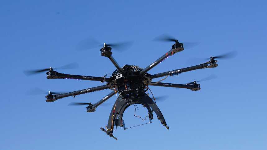
Photo courtesy of UF/IFAS
Hardly a day goes by that unmanned aerial vehicles (UAVs; aka, UAS; aka, drones) don’t find their way into the news or in the popular culture. And, it is likely that UAVs were stocking stuffers for many on Christmas morning as the technology continues come down in price and becomes more widely available.
There has been a lot of speculation on the potential use of the aircraft in agriculture. And, growers and UAV services are putting their toes in the water finding uses in agriculture. The University of Florida has been studying the technology for 15 years with its Unmanned Aircraft Systems Research Program. The research was primarily initiated to be used in natural resource applications. For example, the technology could be used to track wildlife and habitat assessments.
“This technology also can be one more tool in the agriculture toolbox,” says Amr Abd-Elrahman, an associate professor for geomatics at the Gulf Coast Research and Education Center and a member of the UAS team. “However, the development of techniques to calibrate and analyze the UAS imagery has not progressed as rapidly as the desire to fly these systems. Development of computing methods to analyze the data and test different applications are the highest priority. Miniaturizing and integrating specialized sensors, such as LiDAR (Light Detection and Ranging), thermal, and hyperspectral sensors, is another priority.”
Flying Down The Row
As UAV technology becomes more mainstream, the obvious question is: How can Florida growers utilize the aircraft to grow better and more productive crops. There’s a lot of effort being put toward the question and applications are being sought in tracking one of the state’s biggest challenges — HLB in citrus.
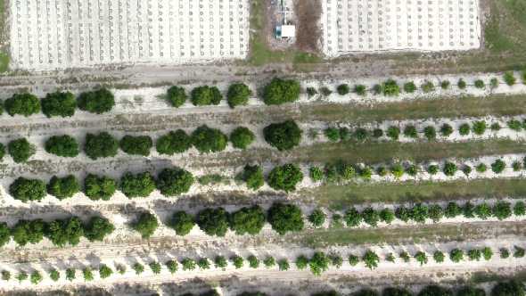
Photo courtesy of UF/IFAS
Reza Ehsani, an ag engineer with UF/IFAS, has been utilizing UAVs equipped with special equipment to gauge stress in citrus trees from above. Using humans to scout for HLB and other stresses is costly, so much so, that many growers have stopped scouting for the disease altogether. But, what if a small UAV could hover over a grove and provide instantaneous information on the stress levels of trees below?
That’s what Ehsani and fellow colleagues are looking to prove out in their research. The UAVs in use are small and fully automated with waypoint navigation, making them easy to operate. Some weigh as little as 2 pounds and are 2½ feet in diameter.
“Monitoring for disease, pests, and stress, as well as yield estimation and tree inventory will be the immediate applications for citrus producers,” Ehsani says.
Cameras mounted on the UAVs can provide hyperspectral images that can be used to determine stress in plants/trees. One of the more common tools used to track stress is the normalized difference vegetation index (NDVI). This index already has been used extensively in precision ag practices in row crops, but has generally been collected with manned aircraft.
For example, NDVI imagery has been used in cotton to track vegetative vigor of plants in the field. Using the images, growers can prescribe a variable rate application of plant growth regulators only to places in the field with excessive vegetative growth as identified by the aerial imagery. The technology also can spot areas in fields that might be suffering from a lack of nutrients or stress from too much or too little water.
While it can be difficult to pinpoint a specific disease/stress on a citrus tree from an aerial image taken from a UAV, complicated mathematical techniques could help find specific spectral patterns in images to classify disease and stresses more accurately.
Flyby Produce
Gene McAvoy, a UF/IFAS vegetable Extension agent and longtime contributor to Florida Grower, recently obtained a UAV to evaluate its uses in vegetable production. He purchased a DJI Phantom 2 with Sundance Cinema Aerial Kit. The kit comes with a first-person visual monitor and McAvoy purchased a GoPro Hero 3 camera separately to mount on the device.
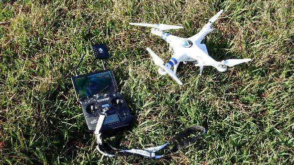
Photo courtesy of UF/IFAS
“The combination of the first-person monitor and camera allows you to see real-time exactly what the camera is seeing from the air,” he says. “I opted for the quadcopter for stability and the ability to move slowly and operate close to the ground and ease of operation.”
McAvoy says UAVs could be used for scouting vegetables for pests and diseases. The Phantom 2 can fly about 20 minutes on one battery charge and can easily cover 40 to 50 acres. With back-up batteries, it is possible to operate for an extended period of time.
“The quadcopter provides the ability to see potential problems from above and fly in close for careful examination,” McAvoy says.
McAvoy adds other uses could be scouting for weed infestations in pastures or forests, estimating stand loss or establishment in crops, checking on livestock, security, checking water levels in wetlands, game counts, inspecting structures, etc. Equipping UAVs with infrared technology should extend the capability into monitoring for drought stress and early disease infestation.
McAvoy is currently awaiting for clearance from FAA to utilize the UAV for these purposes, which he hopes will come within months.
Grower Adoption
Ehsani says he is not aware of any citrus growers using UAVs at this point due to restrictions by the Federal Aviation Administration (FAA) rules and regulations. He says there might be a few growers using the technology more as a hobby for taking aerial shots of their groves, but it is limited to that.
“Outside of the U.S., especially in countries with more relaxed regulations like Chile and Brazil, many more growers are using this technology in their operations,” Ehsani says. “I am aware of crop consultants that provide services like yield estimation to clientele using UAVs in those countries.”
Flying Beyond
While much remains to be done to fully grasp the potential of UAVs in agriculture, there is wide consensus the technology will have a wide-ranging impact on how food is grown.
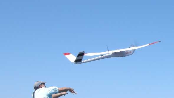
Photo courtesy of UF/IFAS
“There will be different UAVs for different applications,” Ehsani says. “For example, robots for disease and stress detection will be very small and there will be a swarm of them that can fly around the trees or plants in a very coordinated form. They will inspect the trees very closely, collecting very high resolution images. Other proximal sensors will be on board these small robots so that no sign of disease and stress goes undetected. This will allow more targeted application of pesticides and other chemicals, which will save money for growers and will be better for the environment.”
McAvoy, adds, “These UAVs are more than playthings and represent a new technology that if harnessed and employed properly will help keep the Green Revolution going, and along with other technologies, will allow us to meet the challenge of feeding nine billion people in the future. For an old guy who grew up watching “Modern Farmer” on TV in the 1950s, this is fascinating Buck Rogers stuff.”
Regulators Hovering
Probably this biggest reservation looming on the horizon is what moves the Federal Aviation Administration (FAA) will make as more and more UAS crowd the skies. One currently needs a certificate of authorization from FAA to operate the machines.
“Although FAA’s strict regulation is considered one of the main challenges toward wide-scale UAS utilization in commercial applications, we think one can work effectively within the FAA guidelines to address many questions in agriculture,” says Amr Abd-Elrahman, an associate professor for geomatics at the Gulf Coast Research and Education Center. “We see relaxation of some regulations in the future.
“There is a huge difference between those who simply want to fly UAS as a hobbyists in controlled environments and those who would use them commercially in uncontrolled airspace like farms and ranches. Operating a small UAS in the national airspace system still requires at least FAA ground school for operation up to 400 feet — about ground level and within ½ mile line of sight. A private pilot’s license is required for up to 1,200 feet and 1 mile line of sight.
“It is no different than how automobiles must have been treated since their development and use. With increasing accidents, regulations became necessary. The UAS technology is moving so rapidly and incursions with manned aircraft present a safety concern; therefore, FAA is proposing the regulations on the front end. The unlicensed Model-T driver could never have envisioned a written and driving test, much less a 70 mph speed limit and seat belts. And, that technology blossomed more slowly than UAS.”
In December, FAA gave indication of more willingness to work with commercial entities, granting approval to four companies to use UAVs in their operations, bringing the total number of commercial operations with permits to 13.
For more information on FAA regulations, visit FAA.gov/uas.
Subscribe Today For