What’s the Damage? Hurricane Idalia Toll on Florida Ag Upwards of $447 Million
When major Hurricane Idalia made landfall in Florida’s Big Bend area in late August, most of the state’s main ag production centers were spared from the worst. Despite the measured sighs of relief from many growers (this time), there were still plenty of farms and farmland in the direct path of the storm. Preliminary reports are now telling their story. So far, combined estimates indicate up to more than $447 million in total ag losses and damages across Florida from Hurricane Idalia.


View all
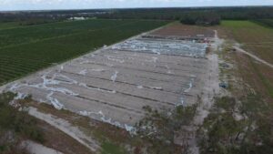
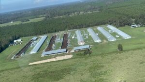
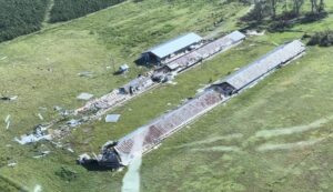
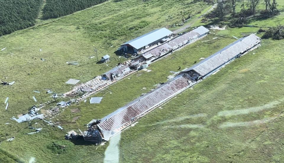
Roughly 3 million acres of agricultural lands were in the storm’s path, including field and row crops, greenhouse and nursery crops, dairy and poultry farms, aquaculture operations, and more.
The commodity categories with the highest predicted losses in Florida due to Hurricane Idalia include:
-
- Field Crops: losses are estimated up to $93.6 million in field crop damages
- Fruits (Non-Citrus) and Tree Nuts: losses are estimated up to $2.6 million in fruit and tree nut damages.
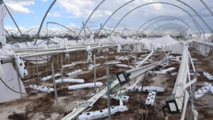
- Greenhouse/Nursery: losses are estimated up to $68.8 million in greenhouse/nursery damages.
- Animals and Animal Products (includes cattle, poultry, aquaculture and dairy): losses are estimated up to $157.6 million in animal and animal product damages, which includes losses to infrastructure and machinery/equipment.
- Vegetables and Melons: losses are estimated up to $60.6 million in vegetable and melon damages.
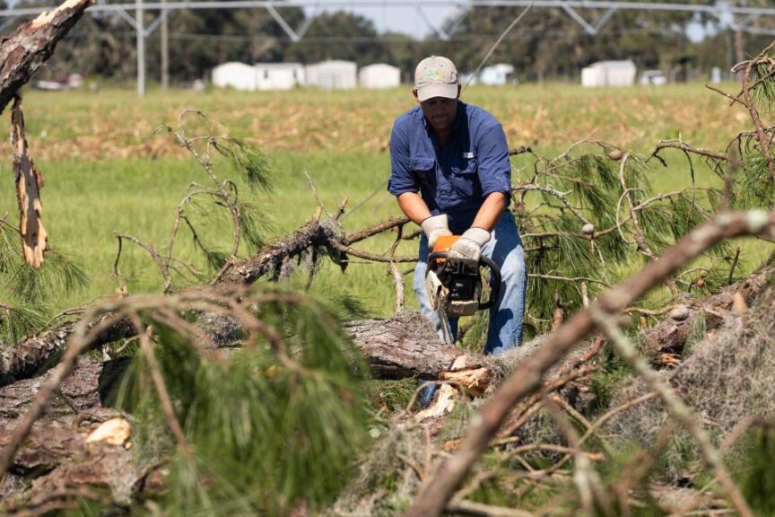
- Forestry: losses are estimated at $64.7 million in timber damages.
The estimates are based on a combination of data obtained from the UF/IFAS Preliminary Assessment of Hurricane Idalia, USDA National Agricultural Statistics Service, the Florida Census of Agriculture, USDA My Market News, Timber Damage Estimates prepared by the Florida Forest Service, and the early communication conducted by the Florida Department of Agriculture and Consumer Services (FDACS) with industry leaders and individual producers.
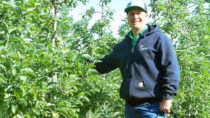
“It’s clear our state’s farmers, ranchers, and growers have a long road to recovery,” says Florida Ag Commissioner Wilton Simpson.
Damage assessments are still ongoing and being processed by the UF/IFAS Economic Impact Analysis Program’s (EIAP).
Program Director Christa Court, Assistant Professor in the Food and Resource Economics Department, says some of the most reported impacts were to infrastructure, such as overturned center pivot irrigation systems, blown-off roofs, and damaged fence lines.
“Although infrastructure damage certainly affects farmers’ bottom lines and occasionally production more directly – as is the case with livestock contained in fencing or buildings, or equipment that irrigates a crop,” she says, “we are not currently able to adequately quantify these infrastructure damages due to a lack of baseline data. However, we do believe that Idalia will help us gather critical information to build this baseline data for future assessments.”
Even with the missing baseline info, the EIAP included a section about the reported infrastructure damages in its report, “Preliminary Assessment of Agricultural Losses and Damages resulting from Hurricane Idalia.”
RELATED CONTENT: What To Know About USDA’s New Crop Insurance Option for Tropical Storms
As a map in the report (pictured below) shows, Hurricane Idalia’s strength was concentrated in its center. The areas directly surrounding where the eye passed – portions of Dixie, Hamilton, Lafayette, Madison, Suwannee, and Taylor counties – experienced Category 2- to 3-force winds; while the areas outside that center path saw a drop-off of windspeeds that maxed out at tropical-storm strength. As such, impacts to agricultural operations in the swath affected by Idalia ranged from major to almost nothing.
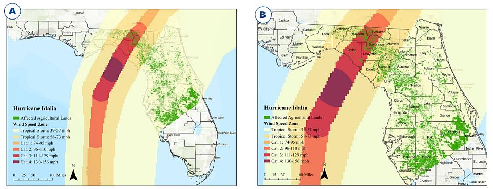
Wind swath pattern of Hurricane Idalia with affected Florida agricultural lands identified. Statewide view of Hurricane Idalia wind swath and Florida agricultural lands presented in panel A. Closer view of Hurricane Idalia wind swath including the Cat. 3 windspeeds (111 to 129 mph) and Florida agricultural lands with Florida counties labeled presented in panel B.
Source: The geospatial data for wind swath of Hurricane Idalia are derived from products published by the NOAA NHC.
The geospatial data for agricultural lands are from the FDACS FSAID ALG.
According to UF/IFAS, to arrive at agricultural loss estimates, the EIAP uses several layers of data gathered from multiple sources. The process includes overlaying the storm’s path, windspeeds, rainfall, and flooding with the acreage, value, and seasonality of the agricultural commodities grown or raised in the counties affected by the storm. This overlay is combined with information about how different commodities are affected by particular storm conditions. Finally, the economists refine their estimates using survey responses submitted by affected agricultural producers and Florida Cooperative Extension faculty.
The survey for agricultural producers to report losses remains open; it is available in English and Spanish. Once a sufficient number of responses are received, the EIAP will release a final report later in the season that will include county-level estimates of production losses.
Stay tuned to see where the final numbers fall.
Subscribe Today For